

Evidence of the first Platte River Valley inhabitants is over 10,000 years old. Native Americans came to this area for similar reasons many people visit today, its beauty and its resources. Historically, the tribes in the area were Ute, Cheyenne, Arapaho, Shoshone, Crow, and Lakota tribes.
By the 1820’s, European explorers and fur traders were drawn to the area because of an abundance of fine pelts. The trappers’ day soon passed, and was succeeded by others, equally brief. Tie cutters, cattle barons, and hunting expeditions came and went.
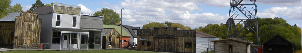
The year of 1897 produced an electrifying change – copper mining in Wyoming. A rich copper strike in the Sierra Madres precipitated the new city of Grand Encampment and several satellite settlements. A smelter was constructed which was supplied with copper ore via a 16-mile aerial tramway-longest in the world. The tramway connected the Ferris Haggerty Mine to the Smelter. Power to the smelter was provided by water through a 4 foot wooden pipeline. The smelter had several fires (like most) and then the price of copper fell and really forced the closure. In 1908, the company which had produced two million dollars in copper ore, was indicted for over-capitalization and fraudulent stock sales. The mines closed, and Rudefeha, Dillon, Copperton, Rambler, Battle and Elwood became ghost towns. Encampment and Riverside survived but the “Grand” was quietly dropped.
The Saratoga & Encampment Railroad (S & E RR or the Slow and Easy RR) was eventually constructed, but its completion in 1908 came a little late for the copper boom.
When the copper mining boom ended just after the turn of the century, mines and towns were abandoned and the population of Encampment shrunk from 3000 people to eventually its current population today. Today Encampment boasts 443 people and is supported by the timber, ranching and recreation industries.
The Town of Encampment is nestled in south-central Carbon County between the Sierra Madre and Snowy Range mountain ranges in the south central part of the state. Located forty miles south of Interstate 80 and 85 miles west of Laramie, the tiny town is home to 443 people.
Carbon County is located in the south-central portion of Wyoming and is the third largest county in Wyoming. Its southern boundary is the Wyoming/Colorado border. The Continental Divide, which separates the eastern and western watersheds of North America, runs north and south through the county. The county is a study in contrasts – from snow-capped mountains and high plateaus in the south & north, to vast prairie lands in the east and the Red Desert basin in the west. Elevations range from 5,000 feet in the Red Desert to 12,006 feet in the Snowy Range.
Parts of the Medicine Bow National Forest, located in Carbon County, offer a wide variety of year-round activities, including camping, fishing,and snowmobiling. The valley of the North Platte River in central Carbon County is one of the most productive livestock-raising areas in Wyoming. Wildlife abounds throughout the county and some of the finest fishing spots are just an easy drive away.